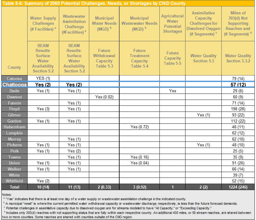
Chattooga table 5-6
An official website of the State of Georgia.
The .gov means it’s official.
Local, state, and federal government websites often end in .gov. State of Georgia government websites and email systems use “georgia.gov” or “ga.gov” at the end of the address. Before sharing sensitive or personal information, make sure you’re on an official state website.
Still not sure?
Call 1-800-GEORGIA to verify that a website is an official website of the State of Georgia.
The Regional Water Plan compares water demand and wastewater flow forecasts along with the Resource Assessments for each county. Management practices seek to address the CNG Region’s likely resource challenges, needs, and shortages (as documented in Section 5 of the Regional Water Plan) or other goals specified by the Council. This page summarizes the potential gaps, needs, or shortages, also referred to as water resource management issues, for the county. All of the information presented may be referenced in the Regional Water Plan.
Insufficient capacity or infrastructure shortages may have multiple solutions such as municipal facility expansions and/or the construction of new local or regional facilities. The intent of this page and the Regional Water Plan is to provide a global overview of the Region, but not to replace or undermine local capital improvement planning.
Table 5-6 summarizes potential 2060 challenges in Chattooga County and other counties in the Coosa-North Georgia Region.
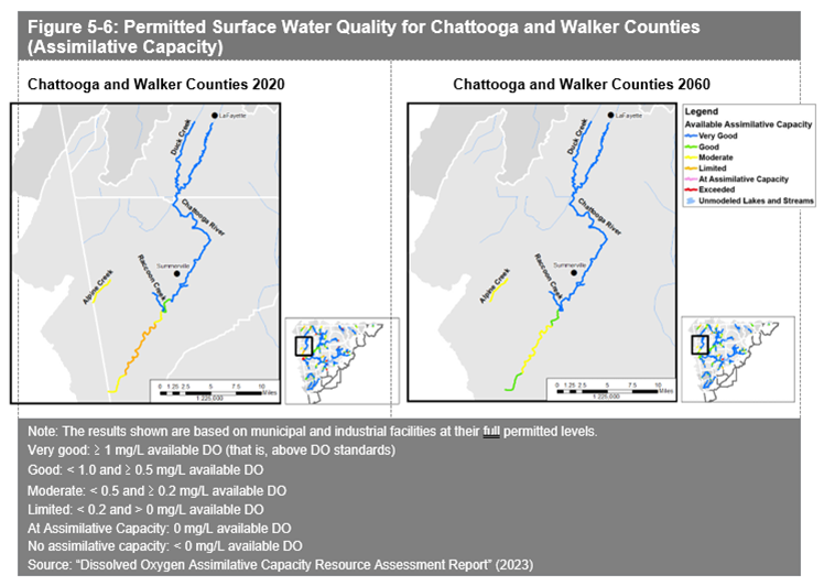
Figure 5-6 shows surface water quality in Chattooga County and the surrounding area.
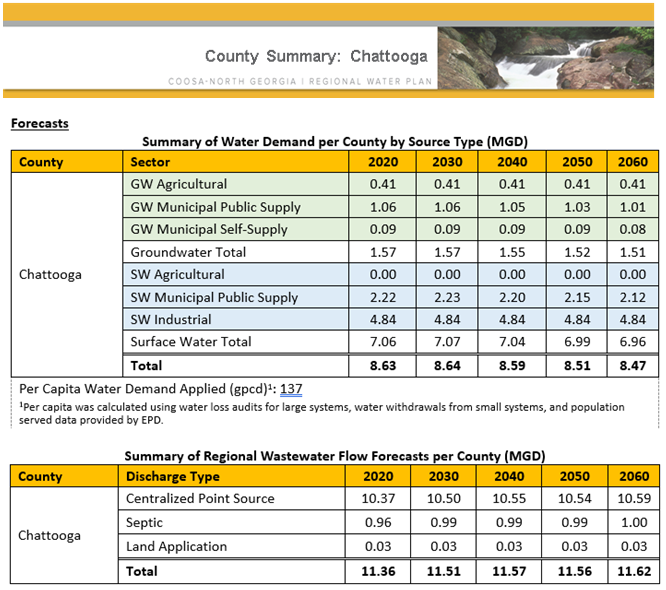
This chart shows the forecast of per capita water demand for the county.